
Explore Copenhagen by steam as you uncover the city’s secret sauna culture, from floating spas in the harbor to historic bathhouses hidden in plain sight. Discover the most relaxing and offbeat wellness experiences in Denmark’s capital.
🌴 Get Your FREE Bahamas Checklist!
Perfect for planning your island escape 🌊
We respect your privacy. Unsubscribe anytime.
Powered by greattravelnews.com
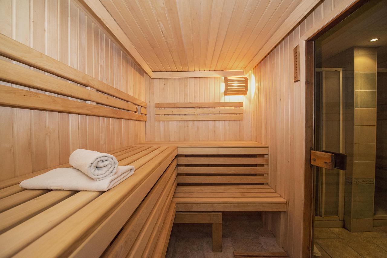
When you think of Copenhagen, you might picture colorful canals, bicycles, and cutting-edge design. But beneath the surface of this stylish city lies a growing culture of quiet warmth: floating saunas and hidden bathhouses that offer a uniquely Danish take on wellness. Whether you’re visiting in the dead of winter or the height of summer, these steamy escapes provide a cozy, offbeat way to experience the city.
The Rise of Floating Saunas in Copenhagen
Copenhagen’s harbor has undergone a transformation in recent years, turning industrial zones into spaces for recreation and sustainability. One of the most unique additions? Floating saunas. These eco-conscious retreats combine scenic views with Nordic wellness traditions.
- CopenHot – Located in Refshaleøen, CopenHot offers a fleet of floating hot tubs and wood-fired saunas with panoramic views of the harbor. You can even book a “sailing hot tub” that cruises while you relax. The minimalist wooden design is both cozy and photogenic.
- GoBoat Sauna – A newer addition to the GoBoat fleet, this floating sauna offers an intimate escape right in the middle of the urban waterfront. Situated near Islands Brygge, it’s a great starting point for exploring Copenhagen by steam.
Floating saunas are often solar-powered and eco-friendly, making them a great choice for sustainability-minded travelers who want to relax while staying green.
Hidden Bathhouses Locals Love
While tourists flock to Nyhavn or Tivoli, locals in the know head to their neighborhood bathhouses. These spots are part of a long-standing Danish tradition that blends socializing with self-care. Hidden in plain sight, they’re easy to miss unless you know where to look.
- Sjællandsgade Bad – Tucked away in Nørrebro, this beautifully restored public bathhouse dates back to 1917. It offers hot water pools, saunas, and steam rooms in a classic tiled setting. The venue also hosts wellness workshops, meditation sessions, and cultural events.
- Frederiksberg Svømmehal – A blend of swimming pool and bathhouse, this art deco complex has one of the city’s best-kept sauna spaces, perfect after a swim. The atmosphere is relaxed, and locals come here to unwind during lunch breaks and weekends.
- Valby Vandkulturhus – A hidden gem located in the Valby district, this modern aquatic center features sauna options and wellness pools that cater to both families and solo visitors looking for tranquility.
These bathhouses are affordable, community-driven, and often overlooked by guidebooks—perfect for travelers who want an authentic Danish experience.
What to Expect (And What to Bring)
Most Copenhagen sauna spots are unpretentious and deeply rooted in Danish culture. Here’s what you should know before you go:
- Bring a swimsuit, towel, and water bottle
- Some saunas are gender-specific; others are mixed
- Cold plunges (even in the harbor!) are often part of the ritual
- Booking ahead is highly recommended, especially on weekends
- Nudity is common in some places—respect local customs and etiquette
Insider tip: Combine your sauna visit with a winter dip in the harbor for the full Nordic experience. Locals swear by it for boosting energy and mood.
Why Saunas Matter in Danish Culture
In Denmark, saunas aren’t just for relaxation—they’re part of a broader cultural value of balance and well-being. Especially during the long, dark winters, locals rely on warmth, light, and communal spaces to maintain their mental health.
This ritual is not about luxury, but about reconnecting with your body, nature, and your neighbors. It’s common to see friends chatting in the sauna, sipping tea between rounds, or heading out together for a plunge in the cold waters.
Seasonal Sauna Events and Pop-Ups
Copenhagen’s love for wellness and design often comes together in seasonal sauna events and pop-up experiences:
- Sauna Festival at Nordhavn – A winter event featuring temporary saunas built by local architects and artists.
- Floating Sauna Nights at CopenHot – Monthly gatherings with music, snacks, and optional harbor swims.
- Sauna on Wheels – Mobile saunas parked around the city for limited-time experiences, often announced on Instagram or local forums.
These events are perfect for visitors looking to connect with locals or explore new neighborhoods.
Final Thoughts
If you’re looking to see a different side of the Danish capital, skip the overdone tourist checklist and try something immersive and authentic. Whether you’re floating on a quiet fjord, plunging into icy water, or sitting in a century-old tiled steam room, exploring Copenhagen by steam is a soothing, unforgettable experience.
Let the heat melt away the stress, and discover why saunas are one of Denmark’s best-kept cultural secrets.